Mailboxes and Old Barns
by
Book Cover & Preview Text
Others Lived There First
Some who drive through eastern Montana on I-94 may see it as a place you go to only to go through, and that’s all right. Even those who love Montana understand why they might.
We were among those who loved it – growing up in that corner of the world, we appreciated and cared for things that surrounded us, whether created by God or worked by man. Over in the corner of our yard near the transformer pole, there was a rock collection which included one that might be both - created by God and worked by man. It looks like a double geode and was turned up during field plowing. It weighs between nine and ten pounds. If it were a rectangle instead of being two perfectly round, solidly joined spheres, it would measure 5 1/2" X 5 1/2" X 8 1/2". It is among those things that ought to be left alone, so it's never been opened or had its inner beauties diagnosed or estimated. It might have been a tool as well, used by those who lived there first.
My brother provides an example of our dad's regard for the land and the ducks when he recalls that Dad was "green” before anyone had dreamed of the term. He maintained grass waterways and refused to break up land that he felt would blow due to the soil being too light. If ducks got a nest started up in the south field before he got in the field in the spring, he farmed around it.
The eastern boundary of the Fort Peck Indian Reservation is about thirty miles west of this 1,180 acre farm our father owned until his death in 1962, when it was purchased by one of our cousins. The Assiniboine and Sioux who rode these prairie hills well into the late 1800s were looking for small game and large, or perhaps observing wolves along the bluffs of the Missouri.
The history of our farmland as their hunting ground was confirmed by the presence of tepee rings in two areas of the pasture, by the tomahawk head found in the field, and the box of arrowheads which Dad found over the decades, many of them in pristine condition. The arrowheads were usually discovered during spring or fall plowing as he sat sideways on the bouncing metal tractor seat watching the leading edge of the plowshares where a large rock capable of causing damage might be turned up. The arrowheads were almost always a dark color and only one to three inches long. They would glisten in the light for just a second or two before the dirt in which they had lain for a hundred or two hundred or five hundred years covered them again.
When he saw that momentary hint of reflected sun, he'd stop the tractor and get down to sift through the dirt where it had flashed and disappeared. Whether it took five minutes or twenty, he'd find it. Its presence and unknown history had already defined it as a treasure, so it would be slipped into the pocket of his overalls to be displayed to the family at supper time before being added to the box. Any time we would ask, "Can we look at the arrowheads?" he would spread them on the table where we sorted them by color, size, shape, or type of rock and he would talk about how they were made, how they were reused when possible, and how they came to be left behind, eventually hidden in the sod.
When Lewis and Clark came through eastern Montana in 1805 after wintering over in what is now Mandan, North Dakota, they would have seen the Missouri River much as it is today. A close read of their diaries indicates they were there around the end of April.
The riverbed, then, as now, concealed agates and shifting sandbars, pockets of quicksand and rattlesnake dens. If they had climbed two hundred feet up the bare bluffs from the riverbed, they might have seen elevated ridges about four miles distant that connected to flatter prairie beyond. One of those ridges is the point at which our upper pastureland dropped to the lower pastures and fields, and right on top of that ridge was one of the two sets of several Indian rings - circles of heavy stones half-buried in the still-undisturbed prairie in the 1950s.
These rings on the ridge have an identifiable doorway and there’s a fire pit in the center of the largest one. From this exposed location, there's an open view of raw hillsides sloping toward the southwest, and based on the history and location of tribes known to have used the area, Dad reasoned that these were the remnants of a hunting camp.
No village would have had so few tepees or been located with such exposure to the weather, but such a spot would offer a useful view of the lower coulees where game might take shelter while resting, feeding, or fleeing. Sometimes on a summer Sunday evening, we would walk out to the ridge to watch the sun set beyond the shadowy silhouette of our little town, barely visible about five miles away as the crow flies.
By about age eight or nine, we understood that the Indian rings represented someone else’s life, work, and heritage - that they were a kind of photograph in the earth. Woe be to the child of any age who disturbed them.
Around 1956, Dad got a letter from the University of Montana asking if he would allow an archeological team to come to the farm and put fences around that location so that they could dig and sift. They got his response as fast as a three cent stamp could deliver it and that was the end of that.
Formats

Book Details
About the Book
Between 1900 and 1910, many Danish families who had transitioned through Ellis Island to Wisconsin, Iowa, and Nebraska boarded the immigrant cars for one more ride with their children, their plows, their horses, their cow, and their trunks. Their final destination was the dry land prairie country in the northeastern corner of Montana—Roosevelt County, Sheridan County, and Richland County.
These essays document historical and family events, personalities, perspectives, and strong memories. The focus may be on a place, a conversation, a news broadcast, a dead calf, a letter, a time of day, or sometimes a shot to the heart received in the middle of some childhood pursuit.
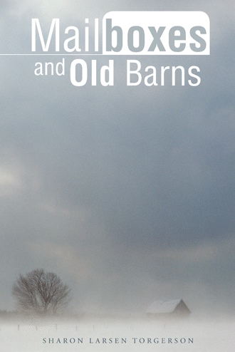
Mailboxes along the roads and old barns set back in fields overgrown with weeds often served as landmarks that told us where we were and how far we had to go. Sometimes they signaled “home” and the end of the road. At other times, barely visible through swirling snow, they told us we had miles to go. When I started compiling these word pictures, I realized they were like those mailboxes and old barns—still identifying important places along the road, still signaling where I am and how far I have to go.
May this work be found to be a faithful record of heritage as it is laid alongside the writings of grandparents, parents, siblings, aunts, uncles, and cousins.
“The lines have fallen to me in pleasant places; yes, I have a good inheritance.”
Psalm 16:6
About the Author
Sharon Larsen Torgerson is the youngest of the seven children of Immanuel and Edith Larsen. Her paternal and maternal grandparents immigrated from Denmark in the 1890s and homesteaded in Roosevelt County and Sheridan County in northeastern Montana. Sharon and her husband, Grant, live in the Willamette Valley in Oregon and have two sons, Jon Sheldon and Eric Burton.